Assignment:
Learning Objectives:
• Demonstrate an understanding of the importance of the tidal changes to the economy and daily living in coastal communities.
• Show how to use a tide chart
• Explain the tidal cycle
• Describe the main forces involved in a tidal cycle
• Interpret buoy and weather stations
Questions:
1. What are the major factors that influence tidal fluctuations?
2. Explain what happens to the level of the tides during the phases of a moon cycle from new moon to full moon to new moon.
3. How does the moon's elliptical orbit affect the tides?
4. How does the moon's perigee or nearest point of orbit affect the tides?
5. How does the moon's apogee or farthest point of orbit affect the tides?
6. What is meant by ebb tide? Flow tide?
7. How are spring tides different from neap tides?
8.A. How many low tides in a 24-hour period in Massachusetts? High tides?
8.B. Do we have semidiurnal, diurnal, or mixed tides in Massachusetts?
9. View the following website: ma.usharbors-com (tide chart)
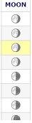
What is the tidal range for July 2018 in Boston Harbor? To determine the tidal range, list the lowest tidal height and the highest tide height. Please include the specific dates and times for the lowest tide and highest tide along with the moon phase (see far left column to determine the moon phase.
10. Use MS Excel create a spreadsheet and graph that highlights the tidal pattern for Boston Harbor for a 48-hour period for July 12 - July 15, 2018. Be sure to upload your MS Excel file to Moodle along with the answers to your tidal questions.
Here is how to set-up your MS Excel spreadsheet. Notice that I've listed the times in chronological order on the MS Excel spreadsheet. Enter the data for 7/14 and 7/15.
|
Date
|
Time
|
Boston Harbor Tide
|
|
7/12/18
|
4:56AM
|
-1.3
|
|
7/12/18
|
11:08AM
|
10.2
|
|
7/12/18
|
5:09PM
|
-0.4
|
|
7/12/18
|
11:22PM
|
12.1
|
|
7/13/18
|
5:50AM
|
-1.7
|
|
7/13/18
|
12:03PM
|
10.5
|
|
7/13/18
|
6:03PM
|
-0.6
|
|
7/14/18
|
|
|
|
|
|
|
|
|
|
|
|
|
|
|
|
7/15/18
|
|
|
10. Visit the following web :neracoos-org
From the interactive map, located the buoy AO1 near Boston: NERACOOS Gulf of Maine A - Massachusetts Bay Lat: 42.52 Lon: -70.56
What data is provided by this buoy?
11. Who and how could this information on a tide chart and buoy help a person who makes his/her living on the coast?